3D GPR Data
A very concluding demonstration performed just in front of our office.
The data show the concrete bands, the rebar and the pipes below the street.
Una demostració es va fer al costat del nostre despatx.
Les dades mostren el formigó, l’armadura i les canalitzacions del carrer.
Ùltims projectes – Our last surveys
Descripció geofísica d’elements arquitectònics del Recinte Històric de Sant Pau. En Col·laboració amb SAPIC i ONL arquitectura.
Geophysical description of architectonic elements of the Historic Site of Sant Pau. With SAPIC and ONL arquitectura.
L’adquisició incloïa el mapeig d’una selecció de façanes i voltes. Els objectius són la descripció de l’estructura metàl·lica no accessible i l’avaluació del seu estat de conservació.
The survey included the mapping of selected facades and vaults. The objective were to detect the main iron frame of the building and its grade of conservation.
Youtube video: unusual data acquisition
Exploració geofísica de l’entorn de l’església de Santa Margarida de Martorell. Projecte conjunt amb el Centre d’Estudis de Martorell.
Geophysical exploration of the surroundings of the middle age church of Santa Margarida of Martorell. Achieved with the Center of Studies of Martorell.
En previsió de l’excavació d’estiu de 2011, es va decidir realitzar el mapeig del subsòl a l’entorn de l’església. L’objectiu va ser la descripció de les possibles estructures constructives relacionades amb la basílica i la ubicació de futures cales d’exploració.
En preparation of the excavations scheduled for this summer, a geophysical mapping around the Church using a GPR was performed. The survey aimed to describe the possible constructive structures and to decide the location of exploratory trenches.
Descripció geofísica de la Vila Romana de Pedroso de la Armuña, Salamanca. En Col·laboració amb el Dr. Enrique Ariño.
Geophysical description of the Roman Villa of Pedroso de las Armuñas, Salamanca. With PhD Enrique Ariño.
En el marc del estudi arqueològic de la vila Romana de Pedroso de la Armuña, es va decidir fer una prospecció geofísica multi-sistema per a la delimitació i descripció dels principals elements arquitectònics del conjunt.
Within the archaeological study of the Roman Villa of Pedroso de las Armuñas, a multi-system geophysical survey was conducted in order to locate and describe the main constructive elements of the Villa.
Detecció de pous antics per les obres soterrament dels ferrocarrils a Sabadell. En Col·laboració amb GS enginyeria.
Old wells detection prior to the extension of the FGC railways in Sabadell. With GS enginyeria.
Detecció preventiva d’antics pous amb GPR en el traçat de la nova línia subterrània dels ferrocarrils.
In order to prevent problems during the extension of the FGC railway, old wells still present in the houses over the future railway were detected using a GPR and sealed.
Adquisició multi-sistema a jaciment ibèric de Moli de l’Espígol 5Tornabous, Catalunya). En col·laboració amb Dr. Jordi Principal.
Multi-system survey at Molí de l’Espígol (Tornabous, Catalonia). With PhD Jordi Principal.
Exploració de la trama urbana de la ciutat ibèrica amb georadar i prospecció magnètica de l’exterior. L’objectiu era la la obtenció d’una cartografia de zones no explorades del jaciment per a planificar noves campanyes d’excavació.
Exploration of urbanism of the iberic city using GPR and magnetic survey of the surroundings. The objective was to map unexplored areas of the site for the planning of excavations.
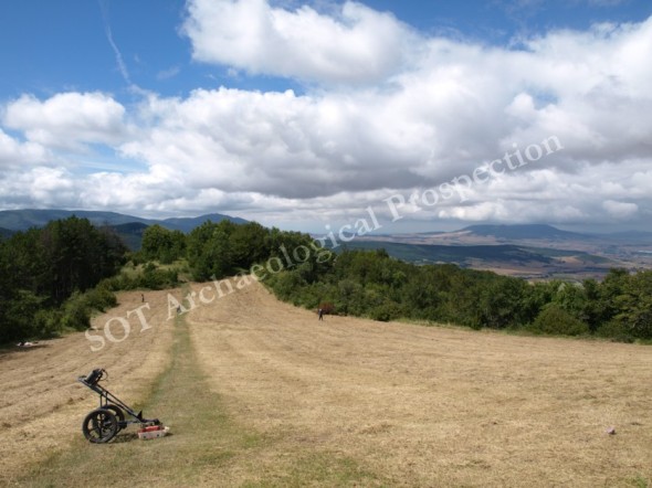
Exploració geofísica multi-sistema del poblat d’Irulegi, Lakidain, Navarra. En Col·laboració amb Fundación Aranzadi.
Multi-system geophysical survey at the archaeological site of Irulegi, Navarra. With the Aranzandi Foundation.
Detecció de restes arqueològiques romano-republicanes a les proximitats del Castell medieval de Irulegui. Es van aplicar prospeccions de Georadar, elèctriques i magnètiques
Remains dating of the Roman Republic were detected below the middle age Castle of Irulegi. A multi-system geophysical prospection including GPR, magnetic and electric surveys was conducted in order to map and delimit the extension of these remains.
Segona fase de mapeig geofísic de la ciutat Romana de Lancia, León. En Col·laboració amb Jesús Celis I Jesús Liz.
Second phase of the geophysical mapping of the Roman city of Lancia, Leon. With Jesús Celis I Jesús Liz.
Es va realitzar la segona campanya de cartografia geofísica de la ciutat Romana de Lancia i es vq delimitar el fòrum d’època imperial. Amb la campanya de 2009 ja s’han explorat 5 Ha de la ciutat.
The second geophysical survey of the Roman city of Lancia was achieved last September and the forum of the city was mapped. The total area explored after the two campaigns of 2009 and 2010 is of 5Ha.


